MPB 38-16-07

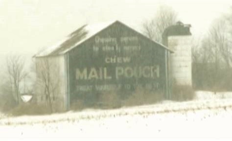
Photo 1
Sides Painted
1
Color
Black
Structure
Barn
Unique Characteristics
None, Serves to steady nerves
Still Standing
No
Credits

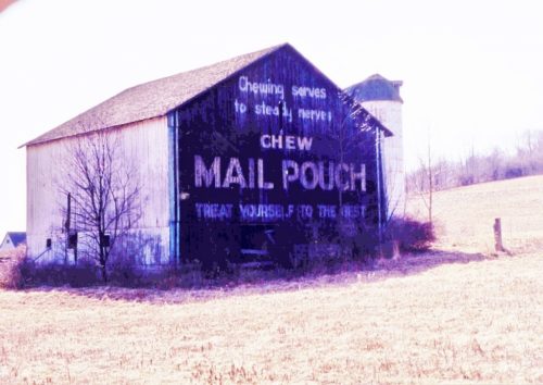
Photo 1 by Emerson Miller (2000 - from album donated by daughter Darlene Long).

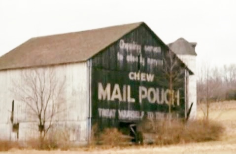
Photos 2 & 3 by unknown.

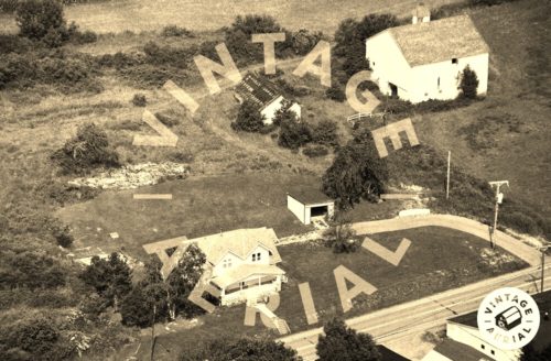
Photo 2 by unkown VA # 9-UCN-11 (1993) courtesy of Vintage Aerial

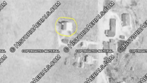
Photo 5 Historic Aerial imagery (1968) courtesy of Historic Aerials

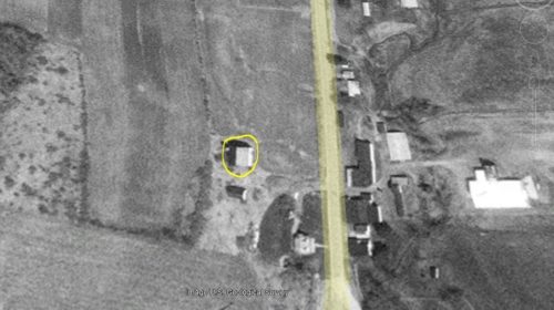
Photo 6 US Geological Survery imagery (Apr. 17 1993).

Photo 7 Google street view (Sept. 2014).

Photo 8 Google satellite image.
Other Information

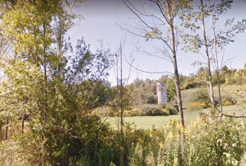
Photos 4-7 provided to show the information used to determine where this barn was once located. In Photo 4 compare the details on the side of the barn with the details on the side of the barn in Photos 1 & 2. In addition the building shown at the rear of the barn in Photo 1 is clearly visible in Photo 4. The Historic Imagery helped to tie down the location. The Miller Photo was dated 2000. Historic imagery shows this barn was existing as far bck as 1962; however, by 2004 the barn had been razed. The silo remians and is visible in Photo 7.

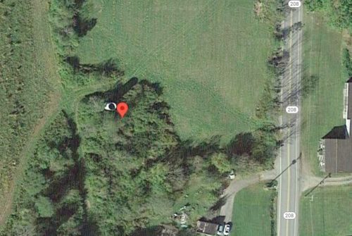
Photo 8 the red pin is adjacent to the remaining silo. This was used to help determine the address and the coordinates.
Where to find it

*GONE* (razed and removed - silo remians) Along the west side of PA-208 south of Frayburg Rd. (PA-157/PA-208) intersection, in Fryburg, by 1.0 mile. The barn was on the right side of the highway headed south from Fryburg. The Mail Pouch sign faced north. One end. Black background.
Address
18407 PA-208
City
Marble
State
PA
Zipcode
16364
Country
USA
Latitude
N 41° 20.4756'
Longitude
W -79° 26.3546'
lat
41.341260
lng
-79.439243
  • Photo 2
  • Photo 3
  • Photo 4
  • Photo 5
  • Photo 6
  • Photo 7
  • Photo 8