MPB 35-56-27

Photo 1
Sides Painted
1
Color
Black
Structure
Barn
Unique Characteristics
None
Still Standing
No
Credits

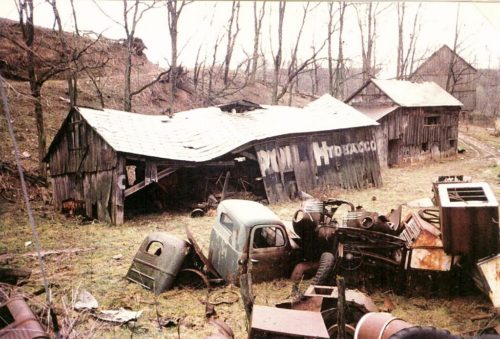
Photo 1 by unknown (1987).

Photo 2 by unknown ODOT # 8897-3-46 (Mar. 24, 1992) courtesy of Ohio Dept of Transportation

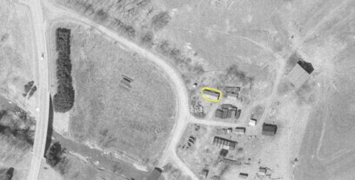
Photo 3 by unknown ODOT # 4806-2-41 (Apr. 8, 1971) courtesy of Ohio Dept of Transportation

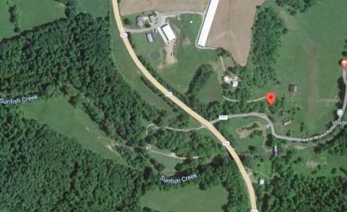
Photo 4 Google satellite image.

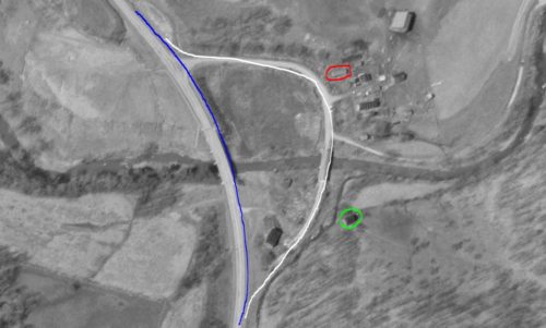
Photo 5 by unknown ODOT # 1868-2-31 (Mar. 14, 1961) courtesy of Ohio Dept of Transportation
Other Information

This barn was originally mislocated. Information on the photo stated that the Barn was on the Clayton Christman farm along Waterworks Road, off of OH-800 just south of Uhrichsville.The barn was on the same site as another Mail Pouch barn (now ID'd as MPB 35-56-28). The Uhrichsville Histoical Society was contacted and a request made for any information regarding the farm location. There was never a response. The Ohio Dept. of Transportation arerial photo archives were searched. There were many photos in the area; however, none before 1961. The photos for the two barns were dated 1987 and were accompanied by another photo (subsequently ID'd as MPB 35-56-25) which was noted to be a barn on the Thurman Christman Farm along OH-800 south of Uhichsville. Obituary records were searched and there was an obituary for a Thurman Christman, and a Clayton Christman, both in Monroe County, near Woodsfield. A search of the maps around Woodsfield revealed that there is a Waterworks Rd off of OH-800 just north of Woodsfield (which is still south of Uhrichsville by quite a distance). The Ohio Dept of Transportation aerial Photo archives were researched (1960's - 1980's) and the barn was located. Sometime prior to 1960 OH-800 was relocated. Photo 5 shows OH-800 as it is currently (blue hi-lite); and OH-800 how it was routed originally (white hi-lite). MPB 35-56-27 sign was painted on the barn when the main route ran within close proximity to the barn giving a very clear view of the sign to traffic travelling north from Woodsfield. In Photo 5 MPB 35-56-27 is circled in red and MPB 35-56-28 is circled in lime.

Photo 2 is an enlarged view of the south side of the barn , the Mail Pouch sign is visible.

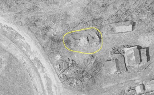
Photo 3 the Mail Pouch barn is circled in yellow. This is for coordination with Photo 4 (Google satellite image). In Photo 4 the red pin marks the location of the barn. This pin was used to determine the address and the coordinates.

Where to find it

*GONE* (fallen - unknown if the remains were removed. Trees and brush cover the location) Along the northeast side of OH-800 north of N. Main St. in Woodsfield, by 1.8 miles. The barn was along the old section of OH-800 now renamed Waterworks Rd (CH-999). The Mail Pouch sign faced south. One side. Black Background.
Address
39878 Waterworks Rd (CH-999)
City
Woodsfield
State
OH
Zipcode
43747
Country
USA
Latitude
N 39° 47.1547'
Longitude
W -81° 07.1529'
lat
39.785911
lng
-81.119215
  • Photo 2
  • Photo 3
  • Photo 4
  • Photo 5